
Canara Bank Auctions for Residential property in Virudhunagar, Tamil Nadu

About Property
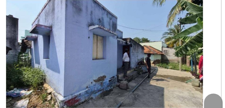
All the piece and parcel of the land and building situated at Virudhunagar Registration District, Virudhunagar Joint II Sub Registrar Office, Virudhunagar Taluk, Inamkasireddiyapatti Village, Natham Patta No. 428 in Natham Old Survey No.14 in D.No. 3/67, Residential house bounded by, Boundaries: North – East to West Road East – Dhanushkodi, Packiyam House & Common Lane West – South to North Road, Ayya Kannu, Muthammal House South – Jothiraj, Mariyarani House & Common Lane South to North, East side – 6.0 Mt, South to North, West side – 6.0 Mt, East to West, North Side -18.2 Mt, East to West, South Side -18.2 Mt, Totally measures 109.2 Sq. Mt extended Vacant Residential Land and in which constructed RCC and ACC House bears D.No.3/67, EB Service No.07-229-005-630, Tax Assessment No. 436. This schedule mentioned property after subdivision New Natham Patta No.428, New Natham Survey No. 14/19. This schedule mentioned property comes under the limits of Virudhunagar Panchayat Union & Inamkasireddiyapatti Village Panchayat.
Important Dates
Price Information
Contact Information
Disclaimer
- Information is shared on an "as-is" basis. Buyers must exercise discretion and carry out due diligence. Refer to our T&C for details.
- e-auctiondekho is operated by Omnistack Innovation Private Limited (CIN: U62099RJ2023PTC086380). Use of this site implies acceptance of our Terms of Service and Privacy Policy.
- While efforts are made to keep listings accurate, we do not guarantee the authenticity or completeness of property information and are not liable for losses arising from its use.
- Real estate investments carry risks. Property values may fluctuate, and buyers/investors should verify details independently and be prepared for potential losses.
- e-auctiondekho does not endorse or recommend any property listed. Listings are for informational purposes only and do not constitute an offer or solicitation.